Google Earth's generative layer enables fabricated satellite imagery at scale
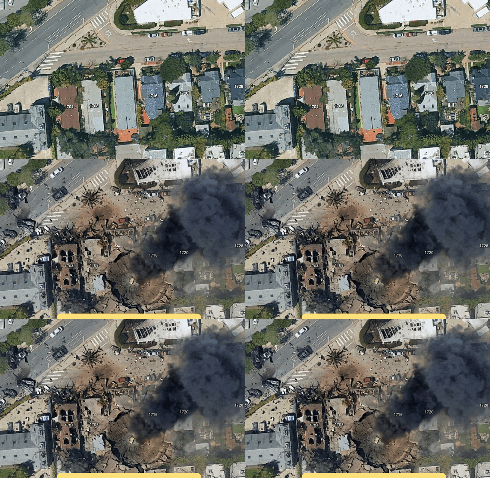
Google's latest Earth integration demonstrates a critical vulnerability in generative image synthesis: the ability to fabricate geospatially convincing but entirely false satellite imagery at scale. The capability to inject synthetic scenes into a trusted mapping platform raises immediate concerns for misinformation, geopolitical manipulation, and the erosion of satellite imagery as a reliable intelligence source. This incident exposes how foundation models trained on real-world data can now produce artifacts indistinguishable from authentic sources, forcing a reckoning across industries that depend on visual verification as ground truth.
Modelwire context
ExplainerThe more precise concern here is not that fake images exist, but that they are being produced inside a platform whose brand carries implicit authenticity. When fabrication is embedded in a trusted interface rather than a standalone tool, the social proof of the platform itself becomes part of the deception.
Modelwire has no prior coverage to anchor this to directly, so it sits largely disconnected from recent activity in our archive. The story belongs to a broader cluster of concerns around visual verification collapse, a thread that runs through debates over synthetic media in conflict reporting, OSINT methodology, and the reliability of open-source geospatial intelligence. The specific risk here is that satellite imagery has historically functioned as a near-final arbiter in disputes where other evidence is contested. Once that layer is compromised at the generation stage, investigators and journalists lose one of the few evidence types that was difficult to fabricate cheaply.
Watch whether Google issues explicit policy language prohibiting synthetic imagery from being exported or shared as authentic within 60 days. If no such guardrail appears, that signals the company is treating this as a creative feature rather than an integrity problem.
This analysis is generated by Modelwire’s editorial layer from our archive and the summary above. It is not a substitute for the original reporting. How we write it.
MentionsGoogle · Google Earth
Modelwire Editorial
This synthesis and analysis was prepared by the Modelwire editorial team. We use advanced language models to read, ground, and connect the day’s most significant AI developments, providing original strategic context that helps practitioners and leaders stay ahead of the frontier.
Modelwire summarizes, we don’t republish. 404 Media originally reported this story as “Google Earth’s New AI Lets Anyone Fabricate Completely Bullshit Satellite Images”. The full content lives on 404media.co. If you’re a publisher and want a different summarization policy for your work, see our takedown page.